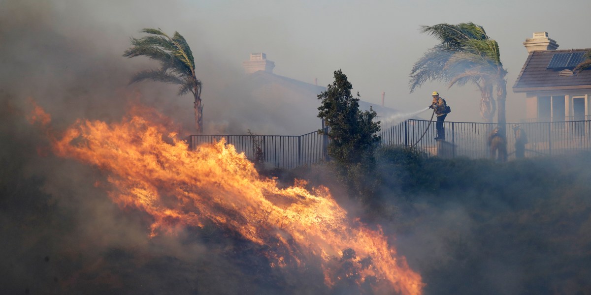
A California utility shut off power in 12 counties in the northern part of the state as a major “diablo wind” — notorious in autumn for its hot, dry gusts — spiked the risk of power lines sparking a wildfire.
About 13,000 customers woke up without electricity Friday after Pacific Gas and Electric shut off power.
The “diablo wind” is forecast to cause sustained winds reaching 35 mph (56 kph) in many areas, with possible gusts topping 65 mph (104 kph) along mountaintops, according to the National Weather Service. The strong winds are expected to last through part of the weekend.
The utility began cutting power Thursday to customers in 12 counties, including Alameda, Contra Costa, Napa, Solano and Sonoma in the Bay Area, and some customers farther north in Colusa, Glenn, Tehama and Shasta counties, PG&E said.
A total of about 20,000 customers could lose power temporarily in the next couple of days, PG&E said in a statement Thursday.
Forecasters have issued red flag warnings for fire danger until Saturday from the central coast through the San Francisco Bay Area and into northern Shasta County, not far from the Oregon border.
“This could end up being the most significant wind event for this year so far,” said meteorologist Brayden Murdock with the service’s Bay Area office. “We want to tell people to be cautious.”
During a diablo wind, common in the fall, the air is so dry that relative humidity levels plunge, drying out vegetation and making it ready to burn. The name — “diablo” is Spanish for “devil” — is informally applied to a hot wind that blows near the San Francisco region from the interior toward the coast as high pressure builds over the West.
Targeted power shutoffs were also possible in Southern California, where another notorious weather phenomenon, the Santa Ana winds, are expected Friday and Saturday.
Santa Anas are dry, warm and gusty northeast winds that blow from the interior of Southern California toward the coast and offshore, moving in the opposite direction of the normal onshore flow that carries moist air from the Pacific into the region.
The National Weather Service issued red flag warnings for the valleys and mountains of Los Angeles County, portions of the Inland Empire, and the San Bernardino Mountains.
Winds around greater Los Angeles won’t be as powerful as up north, with gusts between 25 and 40 mph (40 and 64 kph) possible in mountains and foothills, said Mike Wofford, a meteorologist with the weather service’s Los Angeles-area office.
The strongest winds were being recorded in the Santa Monica and San Gabriel mountains, where Friday there were gusts between 45 and 55 mph with isolated gusts up to 60 mph, he said.
“Humidities are drying out and we have the winds, if we had a fire spark it could really spread quickly because of the current conditions,” Wofford said.
Meanwhile, snow is in the forecast for the mountaintops around Lake Tahoe, where up to 2 inches (5 centimeters) was forecast by Friday morning, according to the National Weather Service in Reno, Nevada. Winds around Lake Tahoe could gust up to 70 mph (113 kph).
The service also issued its first freeze warning of the season along the Sierra’s eastern front effective from 2 a.m. to 9 a.m. Friday from south of Carson City to the north through Reno into Lassen, Sierra and Plumas counties in California where temperatures could dip into the low 20s Fahrenheit (-5 Celsius).
“Frost and freeze conditions could kill crops, other sensitive vegetation and possibly damage unprotected outdoor plumbing,” the service said.

